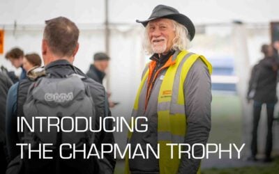
Hear all about the brand new Chapman Trophy, a celebration of the next generation of OMM competitors.
What a fantastic area! The trackless hills, the rocky heights, grassy hilltops contrasting with the areas of peat hags and of tussocks. Glenartney may have been the most challenging area yet.
In August 2023 we explored the Trossachs looking for a new area. We identified some really good potential Event Centres, and a couple of potential Overnight sites, but they were all too far apart. Then and there, Planners Richard and Mike suggested we look at the hills south of Loch Earn. We identified a few possible Event Centres but only one site for the Overnight camp – Glenartney.
Subsequently, I approached the Factor at Drummond Estates and he was supportive despite the fact that the event is always held in the hind stalking season. Fortunately, he was also the Chair of the local Stalking Association and was able to influence the surrounding estates.
We are immensely grateful to Drummond, Ardvorlich, and Glenample Estates for allowing us to send around 1400 people onto these wonderful hills at the peak time for hind stalking.
Of the options for an Event Centre my favoured one was always Dundurn. It had been used for one day of the 2019 Scottish 6-Day Orienteering competition which I attended, and is at the foot of the hills. We were fortunate to be able to agree its use with the farmer at Little Port Farm.
Finally, discussions with Drummond Estate reached agreement on using their site at Glenartney.
Mike and Richard started work on planning, and by May had developed solid plans.
As always, the Hill Team visited the area in early June and spent 5 days walking the hills to check out the proposed controls sites from various perspectives such as safety, difficulty of navigation, and map accuracy over the whole area.
This resulted in 30 significant updates to the map and a few suggestions to change control locations.

Richard and I then discussed the long legs on his courses. My general approach is that legs should be less than 10km as I think that such lengths usually result in very limited route choice. As we discussed them it became obvious that the nature of the area, and the skill of Richard’s planning meant that there was plenty of route choice, which was subsequently proven when watching the trackers.
Similarly, Mike and I discussed the Score Courses. Drummond Estate asked us to avoid anyone going onto Glenartney Forest – the horseshoe-shaped area north of the camp site – to give the deer a safe area on Sunday. This meant that the direct route from the EC to the camp was only available on Saturday. This resulted in one viable route to the controls south of the camp was through the camp itself – an unusual plan – but we agreed that this was acceptable. Another result was that Day 2 courses had to stretch further west into the higher terrain.
My Hill Team always put controls out Monday to Thursday before the event. This time we had requests from 2 of the estates to schedule some routes to minimise impact on stalking. Interestingly these both covered the western part, with Glenample to the northwest stalking Monday and Tuesday, and Drummond to the southwest planning to stalk on Thursday. We complied as we prefer not to be mistaken for deer!

Like last year we didn’t have any marshals at controls as we decided that with the tracking system, and the publication of the availability of mobile signal, we didn’t need them for their safety role. However, one of the tasks that marshals have helped to fulfil is collection of controls after the event. Instead, I recruited a small army of local runners, mainly from local Orienteering clubs to go out on Sunday afternoon; they did a great job and we had all but 2 controls in on Sunday evening, so my great thanks to them. Graham Atkinson had a nice time collecting these on Monday morning and took this picture at the final control.
Harvey Maps are always great for Hill Walking/Running but perhaps many of you who were first-timers won’t have experienced them before. I’ve seen some discussion around the use of 15m contour interval which is the Harvey standard. Harvey’s position, and I agree with them, is that a 15m interval shows the shape of mountainous land well without cluttering it up – they use form lines (contours) to indicate detailed shape where necessary. Another feature unique to Harvey’s is the use of black contours to indicate rocky ground – have another look at the map to spot where brown contour lines change to black.
One of the good points about working with Harvey Maps is the fact that we can make map changes when necessary. As mentioned above, we identified 30 map corrections during our June recce which were then made to the competition map. I know some were disappointed at the lack of names on the map but we arranged for them to be removed to avoid obscuring detail. We also chose to remove all height markings from the map in order to minimise the benefit of using an altimeter.
OOB and uncrossable wall markings are there for a reason, and crossing them is likely to make access permission more difficult in future.
The tracker system enables us to see all transgressions, and we have disqualified those who did break these rules in the results.
Finally, thanks to you, the competitors, for entering and making all of the hard work worthwhile. From the feedback I’ve seen most people enjoyed it.
If you stayed for the second prize giving you will have heard me announce that after 11 years I am stepping down as Race Director. It has been hugely rewarding and I am proud to have been able to lead 9 events in that time (Covid and then a hurricane in 2021 wrecked 2) and to have taken the event to 3 new areas (Black Mountains, Snowdonia and Glenartney).
I am hugely grateful to my Hill Team who freely give their time and expertise to the event every year. I’m also grateful to all the Planners over the years.
One of those members of the Hill Team, Graham Atkinson, was also a Planner (Langdales twice and Snowdonia) and Graham has agreed to take on the mantel. He has already got permission for the 2025 Event Centre and overnight sites.
I hope to see you all next year when we move south to the Lake District but this time I’ll just be along as a member of the Hill Team.
What a fantastic area! The trackless hills, the rocky heights, grassy hilltops contrasting with the areas of peat hags and of tussocks. Glenartney may have been the most challenging area yet.
In August 2023 we explored the Trossachs looking for a new area. We identified some really good potential Event Centres, and a couple of potential Overnight sites, but they were all too far apart. Then and there, Planners Richard and Mike suggested we look at the hills south of Loch Earn. We identified a few possible Event Centres but only one site for the Overnight camp – Glenartney.
Subsequently, I approached the Factor at Drummond Estates and he was supportive despite the fact that the event is always held in the hind stalking season. Fortunately, he was also the Chair of the local Stalking Association and was able to influence the surrounding estates.
We are immensely grateful to Drummond, Ardvorlich, and Glenample Estates for allowing us to send around 1400 people onto these wonderful hills at the peak time for hind stalking.
Of the options for an Event Centre my favoured one was always Dundurn. It had been used for one day of the 2019 Scottish 6-Day Orienteering competition which I attended, and is at the foot of the hills. We were fortunate to be able to agree its use with the farmer at Little Port Farm.
Finally, discussions with Drummond Estate reached agreement on using their site at Glenartney.
Mike and Richard started work on planning, and by May had developed solid plans.
As always, the Hill Team visited the area in early June and spent 5 days walking the hills to check out the proposed controls sites from various perspectives such as safety, difficulty of navigation, and map accuracy over the whole area.
This resulted in 30 significant updates to the map and a few suggestions to change control locations.
Richard and I then discussed the long legs on his courses. My general approach is that legs should be less than 10km as I think that such lengths usually result in very limited route choice. As we discussed them it became obvious that the nature of the area, and the skill of Richard’s planning meant that there was plenty of route choice, which was subsequently proven when watching the trackers.
Similarly, Mike and I discussed the Score Courses. Drummond Estate asked us to avoid anyone going onto Glenartney Forest – the horseshoe-shaped area north of the camp site – to give the deer a safe area on Sunday. This meant that the direct route from the EC to the camp was only available on Saturday. This resulted in one viable route to the controls south of the camp was through the camp itself – an unusual plan – but we agreed that this was acceptable. Another result was that Day 2 courses had to stretch further west into the higher terrain.
My Hill Team always put controls out Monday to Thursday before the event. This time we had requests from 2 of the estates to schedule some routes to minimise impact on stalking. Interestingly these both covered the western part, with Glenample to the northwest stalking Monday and Tuesday, and Drummond to the southwest planning to stalk on Thursday. We complied as we prefer not to be mistaken for deer!
Like last year we didn’t have any marshals at controls as we decided that with the tracking system, and the publication of the availability of mobile signal, we didn’t need them for their safety role. However, one of the tasks that marshals have helped to fulfil is collection of controls after the event. Instead, I recruited a small army of local runners, mainly from local Orienteering clubs to go out on Sunday afternoon; they did a great job and we had all but 2 controls in on Sunday evening, so my great thanks to them. Graham Atkinson had a nice time collecting these on Monday morning and took this picture at the final control.
Harvey Maps are always great for Hill Walking/Running but perhaps many of you who were first-timers won’t have experienced them before. I’ve seen some discussion around the use of 15m contour interval which is the Harvey standard. Harvey’s position, and I agree with them, is that a 15m interval shows the shape of mountainous land well without cluttering it up – they use form lines (contours) to indicate detailed shape where necessary. Another feature unique to Harvey’s is the use of black contours to indicate rocky ground – have another look at the map to spot where brown contour lines change to black.
One of the good points about working with Harvey Maps is the fact that we can make map changes when necessary. As mentioned above, we identified 30 map corrections during our June recce which were then made to the competition map. I know some were disappointed at the lack of names on the map but we arranged for them to be removed to avoid obscuring detail. We also chose to remove all height markings from the map in order to minimise the benefit of using an altimeter.
OOB and uncrossable wall markings are there for a reason, and crossing them is likely to make access permission more difficult in future.
The tracker system enables us to see all transgressions, and we have disqualified those who did break these rules in the results.
Finally, thanks to you, the competitors, for entering and making all of the hard work worthwhile. From the feedback I’ve seen most people enjoyed it.
If you stayed for the second prize giving you will have heard me announce that after 11 years I am stepping down as Race Director. It has been hugely rewarding and I am proud to have been able to lead 9 events in that time (Covid and then a hurricane in 2021 wrecked 2) and to have taken the event to 3 new areas (Black Mountains, Snowdonia and Glenartney).
I am hugely grateful to my Hill Team who freely give their time and expertise to the event every year. I’m also grateful to all the Planners over the years.
One of those members of the Hill Team, Graham Atkinson, was also a Planner (Langdales twice and Snowdonia) and Graham has agreed to take on the mantel. He has already got permission for the 2025 Event Centre and overnight sites.
I hope to see you all next year when we move south to the Lake District but this time I’ll just be along as a member of the Hill Team.

If you have a story to tell, whether it’s from the OMM, another race or challenge or just how you use our kit, get in touch! Just pop an email to marketing@team-ark.com and who knows, you might just earn yourself some free kit!
Hear all about the brand new Chapman Trophy, a celebration of the next generation of OMM competitors.

OMM aficionados Mike & Richard give us their 10-Step Guide to putting together Mountain Marathon courses in their 55th OMM Planners’ Report

Author Alexander takes on the Dragon’s Back Race and shares the four lessons about running and life that he learnt along the way.
Looks like you haven't made a choice yet.